V pátek 26. dubna 2024 úderem 22 hodiny začíná naše nová
a opravdu velká série soutěží o nejlepší webovou stránku !!
Proto neváhejte a začněte hned zítra soutěžit o lákavé ceny !!
a opravdu velká série soutěží o nejlepší webovou stránku !!
Proto neváhejte a začněte hned zítra soutěžit o lákavé ceny !!
Soubor:U.S. Territorial Acquisitions.png
Z Multimediaexpo.cz
Velikost tohoto náhledu je: 800 × 541 pixelů
Obrázek ve vyšším rozlišení (rozměr: 1 536 × 1 038 pixelů, velikost souboru: 1,11 MB, MIME typ: image/png)
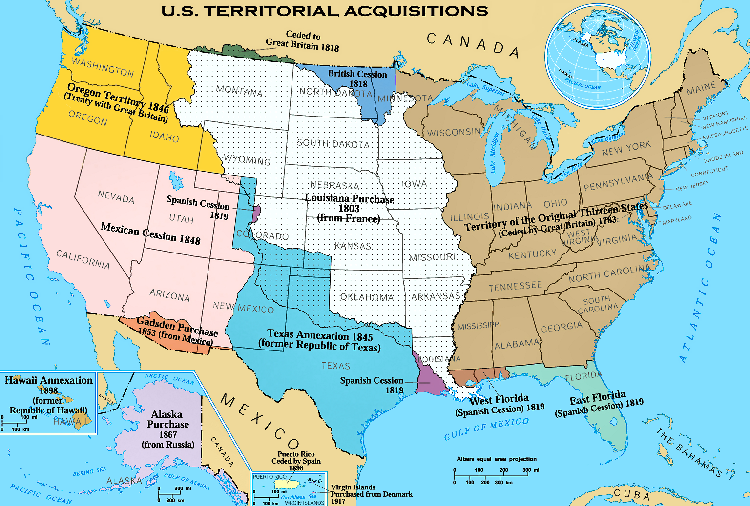
Mapa + English: The Territorial acquisitions of the United States, such as the Thirteen Colonies, the Louisiana Purchase, British and Spanish Cession, and so on.
- Date: 1970, 2006
- Source: National Atlas of the United States
- Author: United States federal government
- (en:User:Black and White converted it from JPEG to PNG and retouched it)
+ pochází z Wikimedia Commons, kde má status – This map was obtained from an edition of the National Atlas of the United States. Like almost all works of the U.S. federal government, works from the National Atlas are in the public domain in the United States.
Historie souboru
Kliknutím na datum a čas se zobrazí tehdejší verze souboru.
| Datum a čas | Náhled | Rozměry | Uživatel | Komentář | |
|---|---|---|---|---|---|
| současná | 8. 4. 2014, 20:50 | | 1 536×1 038 (1,11 MB) | Sysop (diskuse | příspěvky) | (MW1.15-Fotografie) |
- Editovat tento soubor v externím programu (Více informací najdete v nápovědě pro nastavení.)
Odkazy na soubor
Na soubor odkazuje tato stránka:


