Soubor:Satellite image of Madagascar in September 2003.jpg
Z Multimediaexpo.cz
Velikost tohoto náhledu je: 312 × 598 pixelů
Obrázek ve vyšším rozlišení (rozměr: 3 214 × 6 164 pixelů, velikost souboru: 2,94 MB, MIME typ: image/jpeg)
Fotografie + Description:
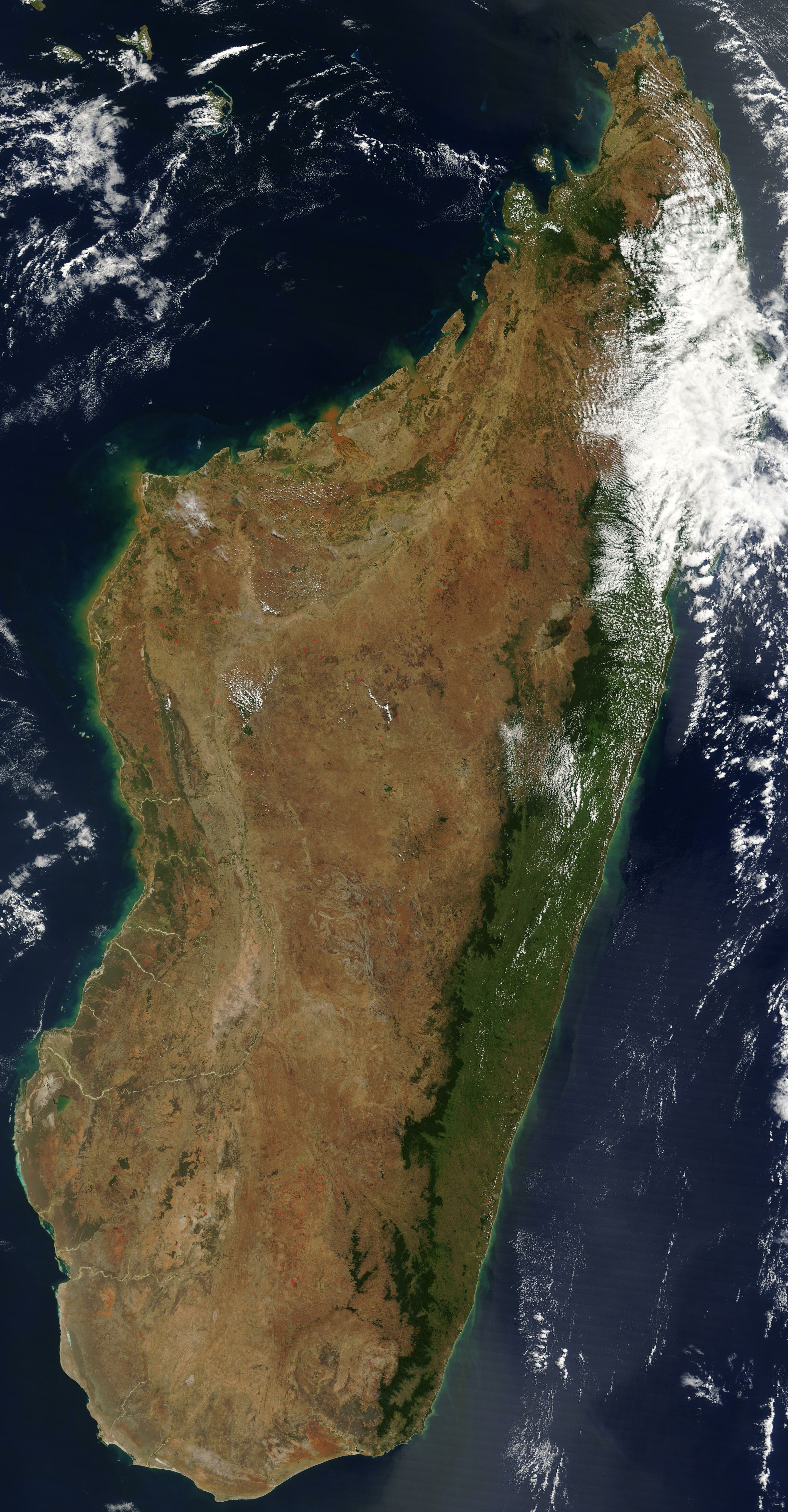
- English: Satellite image of Madagascar in September 2003. Slightly cropped, original taken from NASA's Visible Earth: [1]. Original description:
- The world's fourth largest island, Madagascar, is featured in this Moderate Resolution Imaging Spectroradiometer (MODIS) image taken by the Terra satellite on September 10, 2003. Several active fires, marked with red dots, burn in the central highlands, which are primarily covered with rice fields. The fires are probably controlled burns to clear farmland. The narrow strip of green along the east coast of the island is a rain forest. The west coast is lined with baobabs, a desert tree with a fat trunk, and thorny forest.
- Date: 10 September 2003
- Source: http://visibleearth.nasa.gov/view_rec.php?id=5769
- Author: Unknown author
+ pochází z Wikimedia Commons, kde má status – This file is in the public domain in the United States because it was solely created by NASA.
NASA copyright policy states that "NASA material is not protected by copyright unless noted".
(Use of NASA logos, insignia and emblems is restricted per U.S. law 14 CFR 1221)
NASA copyright policy states that "NASA material is not protected by copyright unless noted".
(Use of NASA logos, insignia and emblems is restricted per U.S. law 14 CFR 1221)
Historie souboru
Kliknutím na datum a čas se zobrazí tehdejší verze souboru.
| Datum a čas | Náhled | Rozměry | Uživatel | Komentář | |
|---|---|---|---|---|---|
| současná | 30. 3. 2013, 12:54 | | 3 214×6 164 (2,94 MB) | Maintenance script (diskuse) | (STARE01) |
- Editovat tento soubor v externím programu (Více informací najdete v nápovědě pro nastavení.)
Odkazy na soubor
Na soubor odkazuje tato stránka:


