V pátek 26. dubna 2024 úderem 22 hodiny začíná naše nová
a opravdu velká série soutěží o nejlepší webovou stránku !!
Proto neváhejte a začněte hned zítra soutěžit o lákavé ceny !!
a opravdu velká série soutěží o nejlepší webovou stránku !!
Proto neváhejte a začněte hned zítra soutěžit o lákavé ceny !!
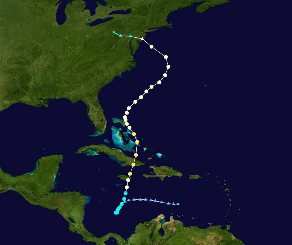
Soubor:Sandy 2012 track.png
Z Multimediaexpo.cz
Velikost tohoto náhledu je: 714 × 600 pixelů
Obrázek ve vyšším rozlišení (rozměr: 1 024 × 860 pixelů, velikost souboru: 570 kB, MIME typ: image/png)
Mapa + English: Track map of Hurricane Sandy of the 2012 Atlantic hurricane season. The points show the location of the storm at 6-hour intervals. The colour represents the storm's maximum sustained wind speeds as classified in the Saffir–Simpson scale (see below), and the shape of the data points represent the nature of the storm, according to the legend below.
- Date: 2012-10-19–2012-10-25
- Source: Created by Cyclonebiskit using WikiProject Tropical cyclones/Tracks. The background image is from NASA. Tracking data is from Tracking data from the National Hurricane Center's running best track.
- Author: Cyclonebiskit
+ pochází z Wikimedia Commons, kde má status – This work has been released into the public domain by its author, Cyclonebiskit. This applies worldwide.
Historie souboru
Kliknutím na datum a čas se zobrazí tehdejší verze souboru.
| Datum a čas | Náhled | Rozměry | Uživatel | Komentář | |
|---|---|---|---|---|---|
| současná | 8. 4. 2014, 16:27 | | 1 024×860 (570 kB) | Sysop (diskuse | příspěvky) | (MW1.15-Fotografie) |
- Editovat tento soubor v externím programu (Více informací najdete v nápovědě pro nastavení.)
Odkazy na soubor
Na soubor odkazuje tato stránka:


