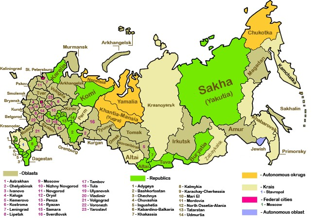
Soubor:Russian-regions.png
Z Multimediaexpo.cz
Větší rozlišení není k dispozici.
Russian-regions.png (rozměr: 644 × 453 pixelů, velikost souboru: 390 kB, MIME typ: image/png)
Mapa + English: Russian Regions
- Based on Image:Federal subjects of Russia (by type).png by Morwen and Nightstallion. Edited by Tavork.
- Chita Oblast' and Aginsk Buryat Autonomous Okrug to merged and formed Zabaykalskiy Kray on 1 March 2008.
- Author: Tavork, Conscious
+ pochází z Wikimedia Commons, kde má status – Permission is granted to copy, distribute and/or modify this document under the terms of the GNU Free Documentation License, Version 1.2 or any later version published by the Free Software Foundation; with no Invariant Sections, no Front-Cover Texts, and no Back-Cover Texts.
Historie souboru
Kliknutím na datum a čas se zobrazí tehdejší verze souboru.
| Datum a čas | Náhled | Rozměry | Uživatel | Komentář | |
|---|---|---|---|---|---|
| současná | 3. 10. 2015, 21:13 | | 644×453 (390 kB) | Sysop (diskuse | příspěvky) | (Fotografie+80+) |
- Editovat tento soubor v externím programu (Více informací najdete v nápovědě pro nastavení.)
Odkazy na soubor
Na soubor odkazuje tato stránka:


