Soubor:New-Map-Francophone World.PNG
Z Multimediaexpo.cz
Velikost tohoto náhledu je: 800 × 441 pixelů
Obrázek ve vyšším rozlišení (rozměr: 2 664 × 1 468 pixelů, velikost souboru: 100 kB, MIME typ: image/png)
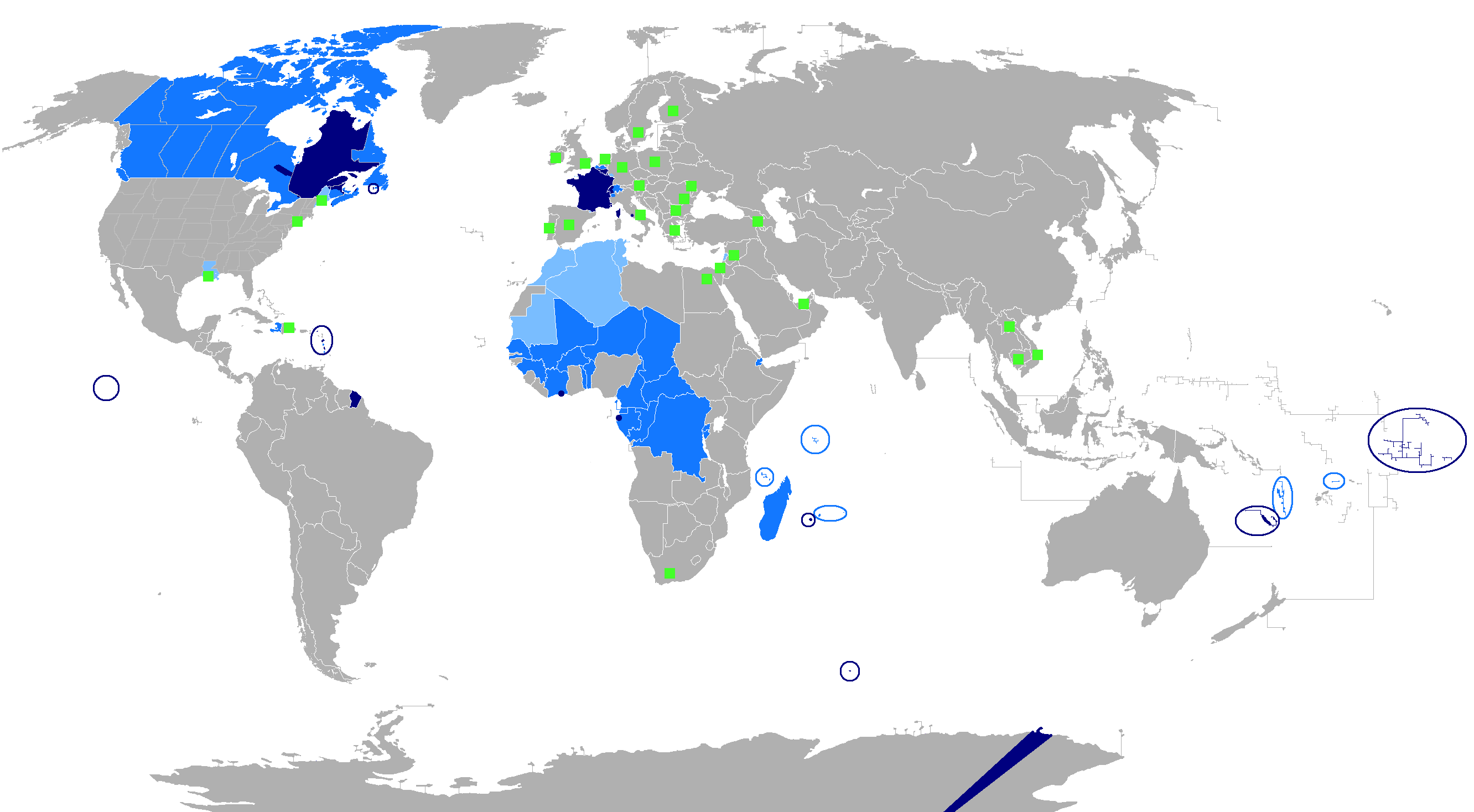
Mapa + English: The French language in the world
- ███ Regions where French is the main language
- ███ Regions where it is an official language
- ███ Regions where it is a second language
- ███ Regions where it is a minority language
- The following things have been changed from the old "Map-Francophone World.PNG":
- Vietnam, Cambodia and Laos are no longer colored in light blue, this is because French is not used there very much these days.
- Lebanon, Tunisia, Mauritania, Morocco, and Algeria have been colored light blue, because the French language is widely used to a degree similar to a second language. There are even more French speakers in those countries than when French was the official language.
- The Western Sahara has been colored light blue, due to the increased use of French there.
- A green square has been added in London to recognize the French-speaking minority there.
- To be modified :
- The status of French language in Africa depends on the country. For instance in Senegal French is not always used in the street and the status of official language fits well whereas in Gabon this is the only used language, except for the eldest between people of a same ethnie so in Gabon the French is the main language.
- Date: 15 August 2007
- Author: aaker
+ pochází z Wikimedia Commons, kde má status – I, the copyright holder of this work, release this work into the public domain. This applies worldwide.
Historie souboru
Kliknutím na datum a čas se zobrazí tehdejší verze souboru.
| Datum a čas | Náhled | Rozměry | Uživatel | Komentář | |
|---|---|---|---|---|---|
| současná | 9. 12. 2016, 00:16 | | 2 664×1 468 (100 kB) | Sysop (diskuse | příspěvky) | (Obrázek + + pochází z Wikimedia Commons, kde má status – Kategorie:CC fotografie ) |
- Editovat tento soubor v externím programu (Více informací najdete v nápovědě pro nastavení.)
Odkazy na soubor
Na soubor odkazuje tato stránka:


