Soubor:Indian Ocean bathymetry srtm.png
Z Multimediaexpo.cz
Velikost tohoto náhledu je: 549 × 600 pixelů
Obrázek ve vyšším rozlišení (rozměr: 800 × 874 pixelů, velikost souboru: 1,2 MB, MIME typ: image/png)
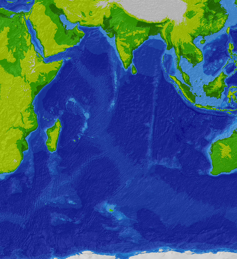
Mapa + English: Topographic/bathymetric map of the Indian Ocean region.
- Source data: SRTM30_plus 30 arc-second satellite elevation data.
- Projection: Winkel I, central median E 80 deg. WGS84 datum.
- Projected and hillshaded using ESRI ArcGIS 9.0. Uploaded by the creator.
- Author: Cdc~commonswiki
+ pochází z Wikimedia Commons, kde má status – Permission is granted to copy, distribute and/or modify this document under the terms of the GNU Free Documentation License, Version 1.2 or any later version published by the Free Software Foundation; with no Invariant Sections, no Front-Cover Texts, and no Back-Cover Texts.
Historie souboru
Kliknutím na datum a čas se zobrazí tehdejší verze souboru.
| Datum a čas | Náhled | Rozměry | Uživatel | Komentář | |
|---|---|---|---|---|---|
| současná | 30. 3. 2014, 18:16 | | 800×874 (1,2 MB) | Sysop (diskuse | příspěvky) | (MW1.15-Fotografie) |
- Editovat tento soubor v externím programu (Více informací najdete v nápovědě pro nastavení.)
Odkazy na soubor
Na soubor odkazuje tato stránka:


