Soubor:Europe 1914.jpg
Z Multimediaexpo.cz
Velikost tohoto náhledu je: 800 × 576 pixelů
Obrázek ve vyšším rozlišení (rozměr: 1 198 × 863 pixelů, velikost souboru: 110 kB, MIME typ: image/jpeg)
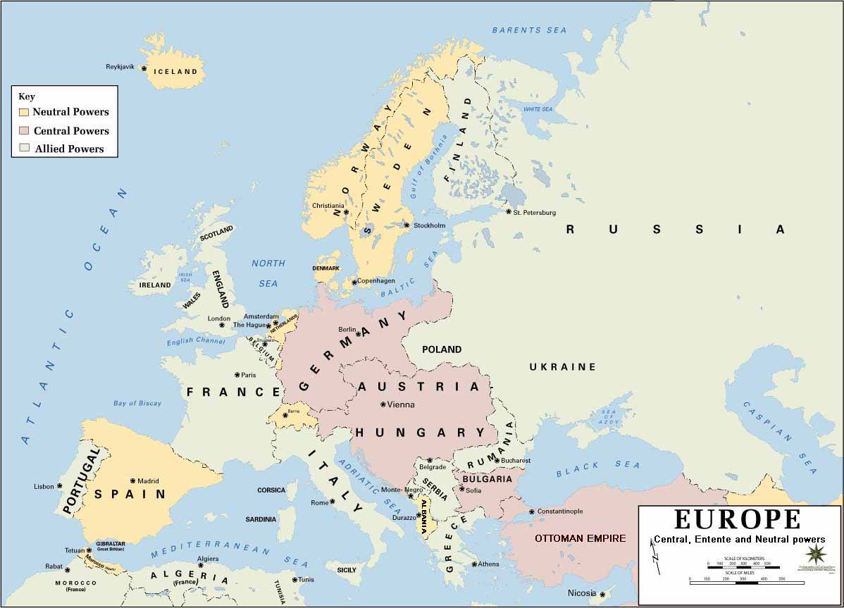
Mapa + Description: European alliances during the 1914-18 war. Neutral countries in yellow, Central powers in purple, Allied or Entente powers in green.
- Background information: In 1938 the predecessors of what is today The Department of History at the United States Military Academy began developing a series of campaign atlases to aid in teaching cadets a course entitled, "History of the Military Art." Since then, the Department has produced over six atlases and more than one thousand maps, encompassing not only America’s wars but global conflicts as well.
- In keeping abreast with today's technology, the Department of History is providing these maps on the internet as part of the department's outreach program. The maps were created by the United States Military Academy’s Department of History and are the digital versions from the atlases printed by the United States Defense Printing Agency. We gratefully acknowledge the accomplishments of the department's former cartographer, Mr. Edward J. Krasnoborski, along with the works of our present cartographer, Mr. Frank Martini.
- Česky: Evropa v roce 1914
- Date:
- Source: www.dean.usma.edu
- Author: Department of History, United States Military Academy
+ pochází z Wikimedia Commons, kde má status – This image is a work of a U.S. Army soldier or employee, taken or made as part of that person's official duties. As a work of the U.S. federal government, the image is in the public domain.
Historie souboru
Kliknutím na datum a čas se zobrazí tehdejší verze souboru.
| Datum a čas | Náhled | Rozměry | Uživatel | Komentář | |
|---|---|---|---|---|---|
| současná | 10. 5. 2017, 19:40 | | 1 198×863 (110 kB) | Sysop (diskuse | příspěvky) | (Mapa + Description: European alliances during the 1914-18 war. Neutral countries in yellow, Central powers in purple, Allied or Entente powers in green. * Background information: In 1938 the predecessors of what is today The Department of History at ) |
- Editovat tento soubor v externím programu (Více informací najdete v nápovědě pro nastavení.)
Odkazy na soubor
Na soubor odkazují tyto 4 stránky:


