Soubor:Austria satellite-map.jpg
Z Multimediaexpo.cz
Velikost tohoto náhledu je: 800 × 433 pixelů
Obrázek ve vyšším rozlišení (rozměr: 2 550 × 1 381 pixelů, velikost souboru: 1,22 MB, MIME typ: image/jpeg)
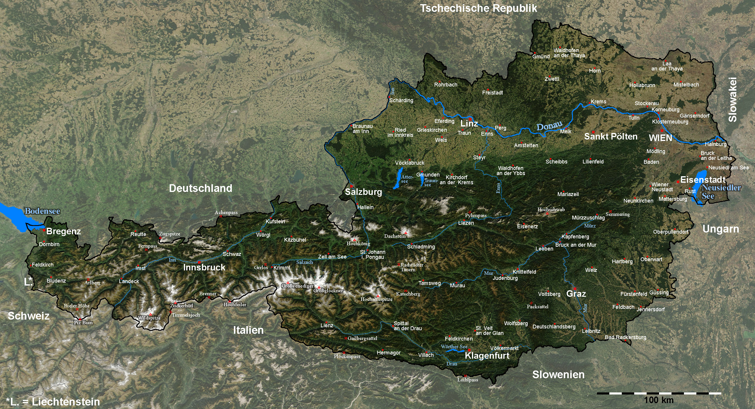
Mapa + Description: Satellite image of Austria with provincial capitals and other annotations
- Date: 11 September 2005
- Source: The image is based on a satellite image. Original image: Credit Jeff Schmaltz, MODIS Rapid Response Team, NASA/GSFC.
- Author: Michael Schmid
+ pochází z Wikimedia Commons, kde má status – This file is in the public domain in the United States because it was solely created by NASA.
NASA copyright policy states that "NASA material is not protected by copyright unless noted".
(Use of NASA logos, insignia and emblems is restricted per U.S. law 14 CFR 1221)
NASA copyright policy states that "NASA material is not protected by copyright unless noted".
(Use of NASA logos, insignia and emblems is restricted per U.S. law 14 CFR 1221)
Historie souboru
Kliknutím na datum a čas se zobrazí tehdejší verze souboru.
| Datum a čas | Náhled | Rozměry | Uživatel | Komentář | |
|---|---|---|---|---|---|
| současná | 5. 4. 2014, 15:03 | | 2 550×1 381 (1,22 MB) | Sysop (diskuse | příspěvky) | (MW1.15-Fotografie) |
- Editovat tento soubor v externím programu (Více informací najdete v nápovědě pro nastavení.)
Odkazy na soubor
Na soubor odkazuje tato stránka:


