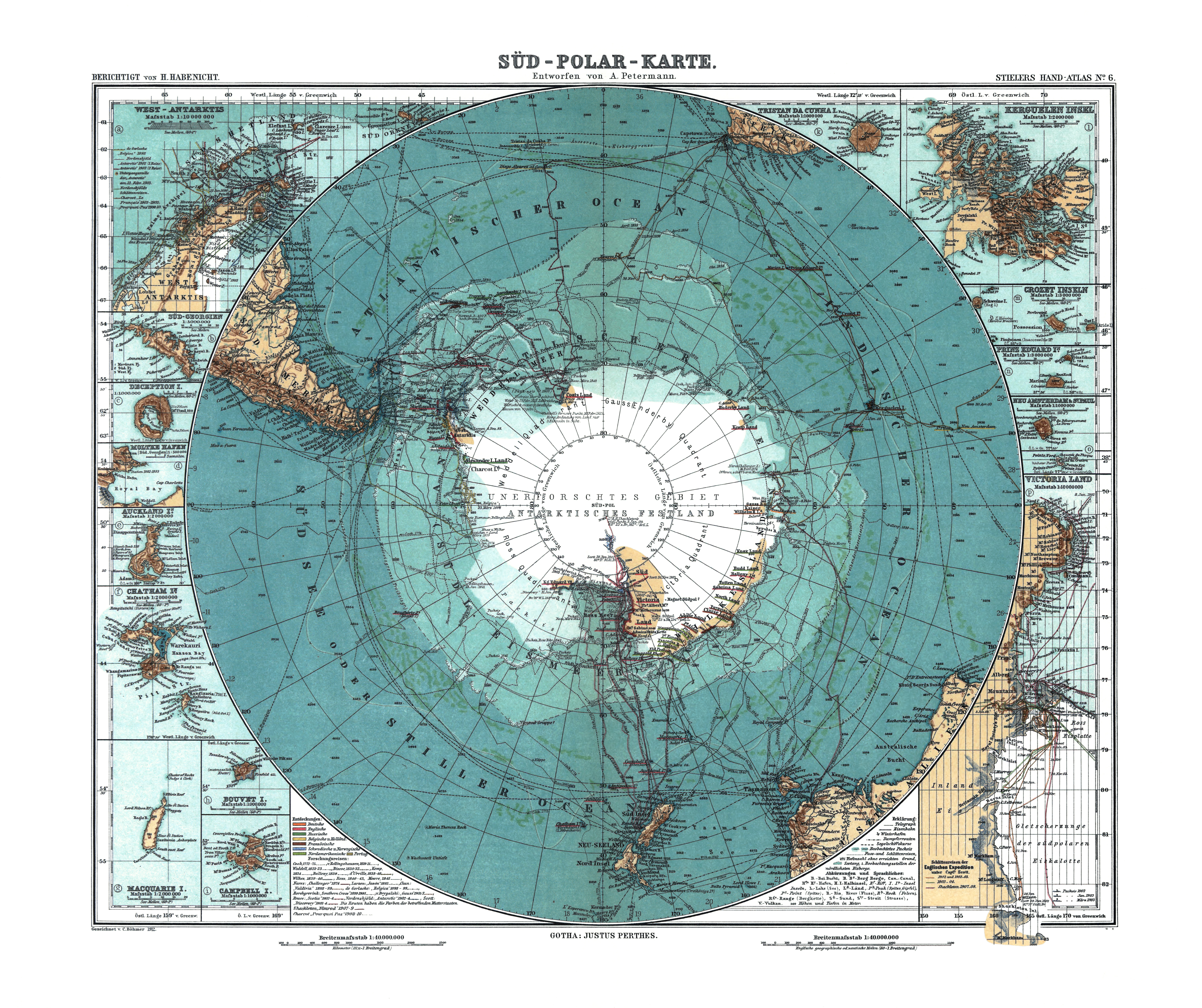
Soubor:Antarctica 1912 edit.jpg
Z Multimediaexpo.cz
Velikost tohoto náhledu je: 715 × 600 pixelů
Obrázek ve vyšším rozlišení (rozměr: 5 676 × 4 763 pixelů, velikost souboru: 17,84 MB, MIME typ: image/jpeg)
GIGANTICKÁ Mapa + Deutsch: Karte der Antarktis. Maßstab [ca. 1:40,000,000]. farbig, 34 × 41 cm.
- English: Map of Antarctica. Scale [ca. 1:40,000,000]. Col., 34 × 41 cm.
- Français: Carte de l'Antarctique, échelle 1:40 000 000e, couleur, 34 × 41 cm.
- Português: Mapa da Antárctica. Escala [ca. 1:40,000,000]. Cor., 34 × 41 cm.
- Date: 1912
- Source: Stieler Handatlas, 9. von Grund aus neubearb. und neugestochene Aufl. 8. berichtigter Abdruck. Verlag J. Perthes, Gotha, 1912.
- This map is available from the United States Library of Congress's Geography & Map Division under the digital ID g9800.ct000774.
- Author: Petermann, A.; Habenicht, H.; Böhmer, C.
+ pochází z Wikimedia Commons, kde má status – This image is in the public domain because its copyright has expired.
Historie souboru
Kliknutím na datum a čas se zobrazí tehdejší verze souboru.
| Datum a čas | Náhled | Rozměry | Uživatel | Komentář | |
|---|---|---|---|---|---|
| současná | 28. 2. 2015, 11:54 | | 5 676×4 763 (17,84 MB) | Student85 (diskuse | příspěvky) | (GIGANTICKÁFotografie) |
- Editovat tento soubor v externím programu (Více informací najdete v nápovědě pro nastavení.)
Odkazy na soubor
Na tento soubor neodkazuje žádná stránka.


