Soubor:1922 world map.png
Z Multimediaexpo.cz
Velikost tohoto náhledu je: 800 × 543 pixelů
Obrázek ve vyšším rozlišení (rozměr: 3 495 × 2 374 pixelů, velikost souboru: 17,29 MB, MIME typ: image/png)
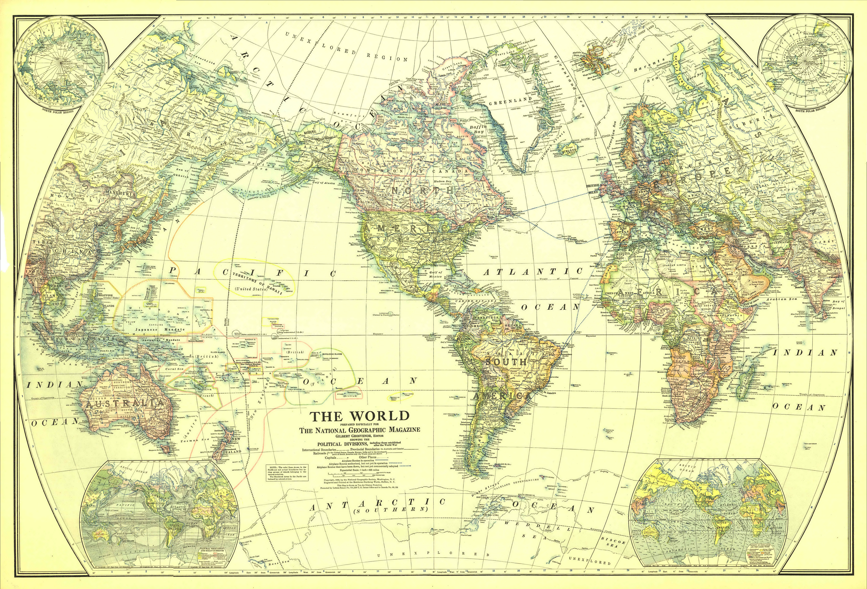
Globální gigantická mapa + English: Map of the World in 1922
- Drawn with Van der Grinten projection. Scale on equator 1 inch = 625 miles (1 : 39,600,000)
- Extra maps in the corners: North and South polar regions, natural vegetation and ocean currents, density of population and prevailing winds.
- Date: December 1922
- Source: The Complete National Geographic Maps Collection
- Author: National Geographic Society
+ pochází z Wikimedia Commons, kde má status – This media file is in the public domain in the United States. This applies to U.S. works where the copyright has expired, often because its first publication occurred prior to January 1, 1923.
Historie souboru
Kliknutím na datum a čas se zobrazí tehdejší verze souboru.
| Datum a čas | Náhled | Rozměry | Uživatel | Komentář | |
|---|---|---|---|---|---|
| současná | 29. 4. 2014, 21:06 | | 3 495×2 374 (17,29 MB) | Sysop (diskuse | příspěvky) | (Globální mapa + + pochází z Wikimedia Commons, kde má status – Kategorie:PD fotografie Kategorie:Maps showing history Kategorie:Mapy světa JPG ) |
- Editovat tento soubor v externím programu (Více informací najdete v nápovědě pro nastavení.)
Odkazy na soubor
Na tento soubor neodkazuje žádná stránka.


