Soubor:1897 Land Office Map of the Island of Molokai, Hawaii - Geographicus - MolokaiHawaii-lo-1897.jpg
Z Multimediaexpo.cz
Velikost tohoto náhledu je: 800 × 424 pixelů
Obrázek ve vyšším rozlišení (rozměr: 5 000 × 2 653 pixelů, velikost souboru: 1,77 MB, MIME typ: image/jpeg)
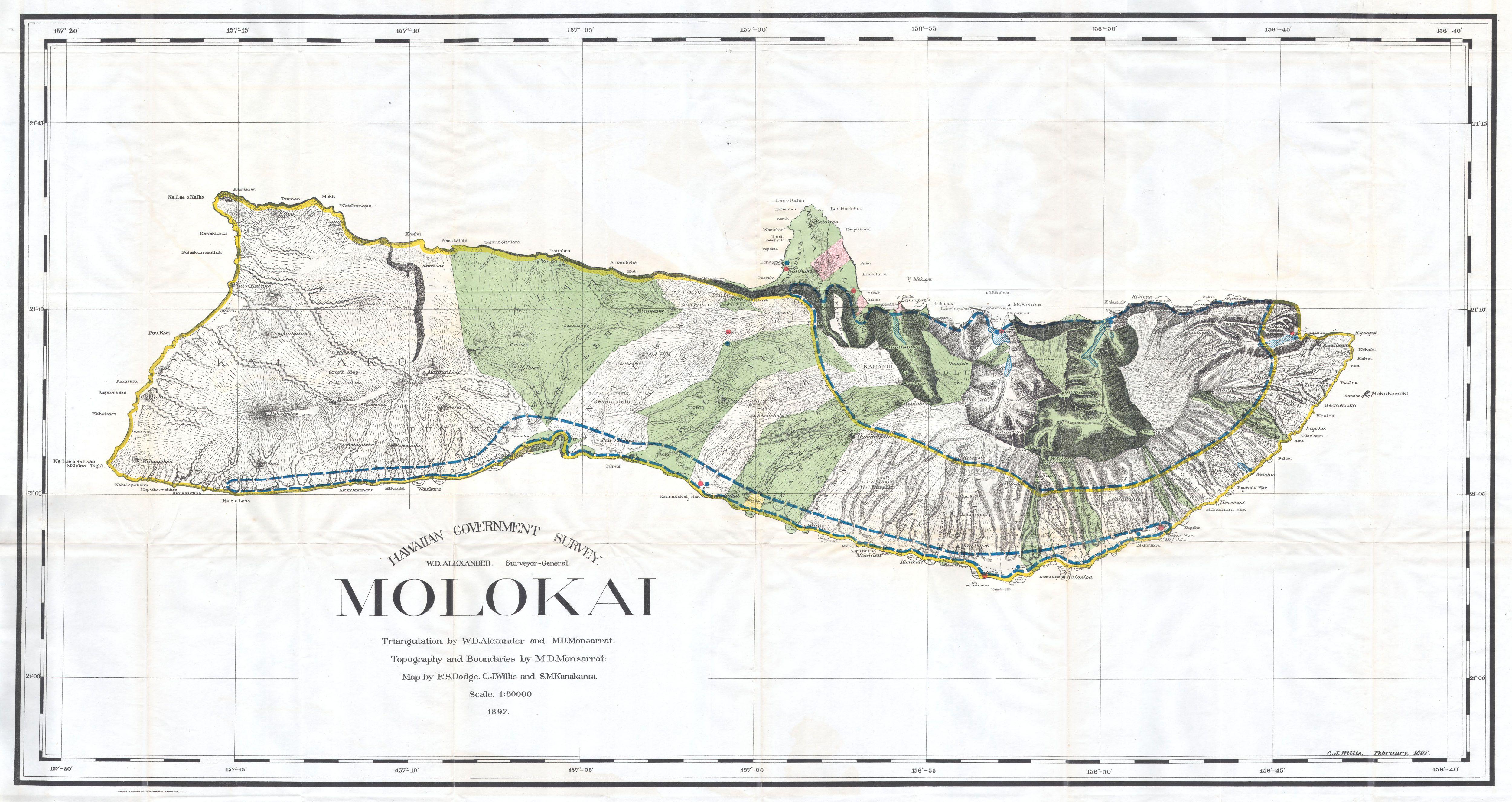
Historická mapa + English: This rare and extraordinary 1897 map of the island of Molokai, in the Hawaiian group, was prepared for the 1906 Report of the Governor of the Territory of Hawaii to the Secretary of the Interior. Though the cartographic work that produced this map was started in 1878, during the Hawaiian Monarchy, the map itself, and the report that contained it, was issued following the U.S. Government’s 1898 annexation of the Hawaiian Republic. The Report was an attempt to assess and examine the newly created Hawaiian Territory’s potential for proper administration and development. Consequently the map focuses on Public Lands, Homestead Settlement Tracts, Grazing Lands, Pineapple Lands, Sugar Plantations, Forest Reserves, Forest Lands, Wet Lands, etc. It also features both practical and topographic details for use in administering the region. At the turn of the century Molokai was has large cattle ranges and considerable grazing. On the northern side of the island there is a six square mile leper colony. The colony, home to about 100 people, was established in 1866 and was considered one of the most advanced institutions of its kind in existence. The Crown Lands, that is those belonging to Kamehameha III, are depicted and drawn according to the divisions of 1848. Today Molokai, due to its lack of sandy beaches, is considered the best preserved of its major islands. The governor of Hawaii at the time this chart was made was George R. Carter. The primary triangulation for this map was accomplished by W.D. Alexander and M. D Monsarrat. The topography by M. D Monsarrat. And, the map itself was drawn by F. S. Dodge, C. J. Willis and S. M. Kanakuni. This map is heavily based upon the H. E Newton Government Survey Regional Map No. 1394.
- Date: 1897 (dated)
- Dimensions: Height: 25 in (63.5 cm). Width: 48 in (121.9 cm).
- Accession number: Geographicus code: MolokaiHawaii-lo-1897
+ pochází z Wikimedia Commons, kde má status – This image is in the public domain because its copyright has expired.
Historie souboru
Kliknutím na datum a čas se zobrazí tehdejší verze souboru.
| Datum a čas | Náhled | Rozměry | Uživatel | Komentář | |
|---|---|---|---|---|---|
| současná | 13. 4. 2014, 09:36 | | 5 000×2 653 (1,77 MB) | Sysop (diskuse | příspěvky) | (MW1.15-Fotografie) |
- Editovat tento soubor v externím programu (Více informací najdete v nápovědě pro nastavení.)


